7 Best Drone Software in 2026, Compared
Compare the 7 best drone software tools for mapping, photogrammetry, flight logs and fleet compliance, with real prices for pilots and teams checked by hand.
 Shamim Mia, Founder, SerpAstraLast verified November 7, 202610 min read
We compare pricing pages, documentation and public reviews. We never accept payment for rankings.
Key takeaways
- DroneDeploy is the most complete cloud platform for flight planning, maps and 3D models, at $4,188 a year for one pilot billed annually.
- Agisoft Metashape is the low-cost way into photogrammetry: Standard costs $179 and Professional $3,499 for a node-locked licence.
- Airdata is the cheapest fleet and flight-log tool, with a free plan for 100 flights and HD 360 Pro at $14.99 a month for 4 pilots and 16 drones.
- Aloft is free for individual pilots for airspace checks and LAANC, with paid Enterprise plans for teams by quote.
On this page
Quick comparison
| Tool | Best for | Starting price | Free plan |
|---|---|---|---|
| DroneDeploy | Construction, energy and inspection teams that want flight planning, cloud processing and 3D models in one platform | $349/mo | No (free trial) |
| Pix4D | Surveyors and engineers who need survey-grade photogrammetry and full control over processing | $333/mo | No (15-day trial) |
| Agisoft Metashape | Pilots and small mapping firms that want desktop photogrammetry for a one-off licence fee | $179 (Standard) | No |
| Airdata | Pilots and small drone teams that need flight logs, battery health and maintenance records | Free; Pro $14.99/mo | Yes (100 flights) |
| Aloft | Pilots who need airspace checks and LAANC authorizations, and teams that need fleet compliance | Free; Enterprise quote | Yes (individuals) |
| Skydio | Inspection teams that want autonomous close-range flight around structures with US-made drones | Custom quote | No |
| ArcGIS Pro | GIS teams that need drone maps inside a wider mapping and analysis system | Custom quote | No (21-day trial) |
Make one of these tools?
We re-check this list every quarter. Send a correction, request a review, or ask about a clearly labeled sponsored spot.
Request a listingThe best drone software

DroneDeploy
Best for: Construction, energy and inspection teams that want flight planning, cloud processing and 3D models in one platform
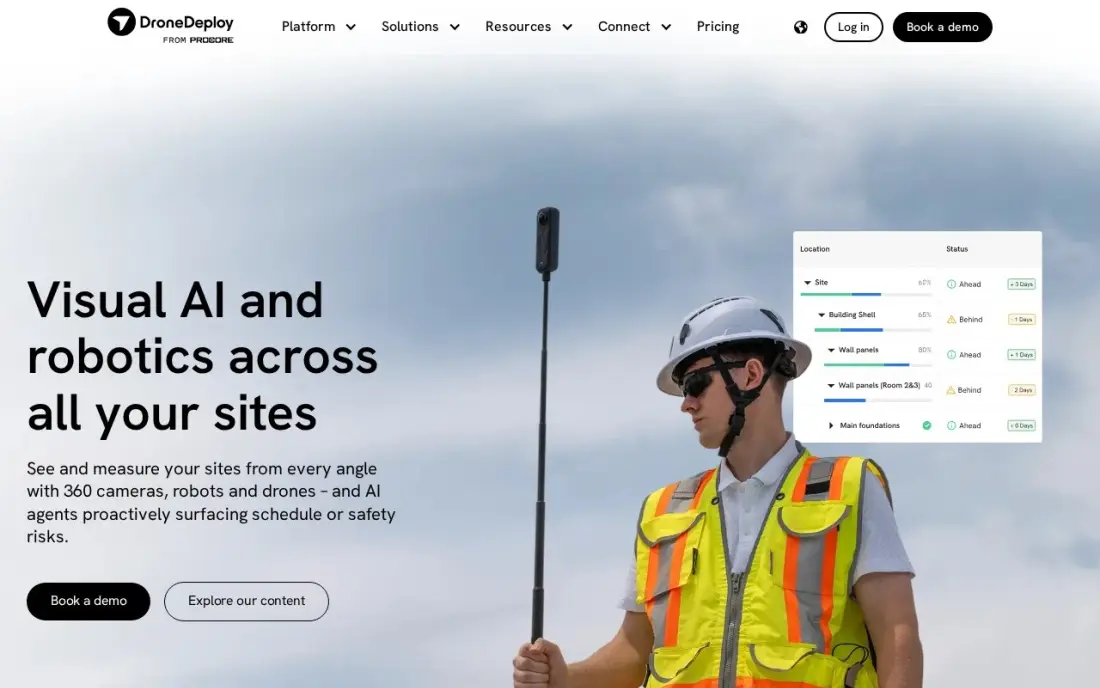
DroneDeploy is the all-in-one cloud platform for commercial drone work. It plans automated flights, processes the images in the cloud and returns orthomosaic maps and 3D models, with AI analysis that flags issues in the imagery. It integrates with Autodesk Construction Cloud and works with Skydio drones, so it fits construction progress tracking as well as inspections.
The Individual plan costs $4,188 a year, about $349 a month, billed annually for one admin user, and the monthly rate is not published. A team needs a quote-only plan, and agriculture users can start on Ag Lite at $1,908 a year. It is the default pick for a business that flies weekly and wants results without learning photogrammetry.
What we like
- Mature automated flight planning and cloud processing for maps, orthomosaics and 3D models
- Fits construction progress tracking as well as energy and inspection work
- Strong integrations, including Autodesk Construction Cloud and Skydio drones
- AI analysis flags issues in captured imagery
Watch out for
- Individual plan covers one admin user only, so a team needs a quote-only plan
- Billed annually only, and the monthly rate is not published
- $4,188 a year is a steep entry price for a pilot who does not fly every week

Pix4D
Best for: Surveyors and engineers who need survey-grade photogrammetry and full control over processing
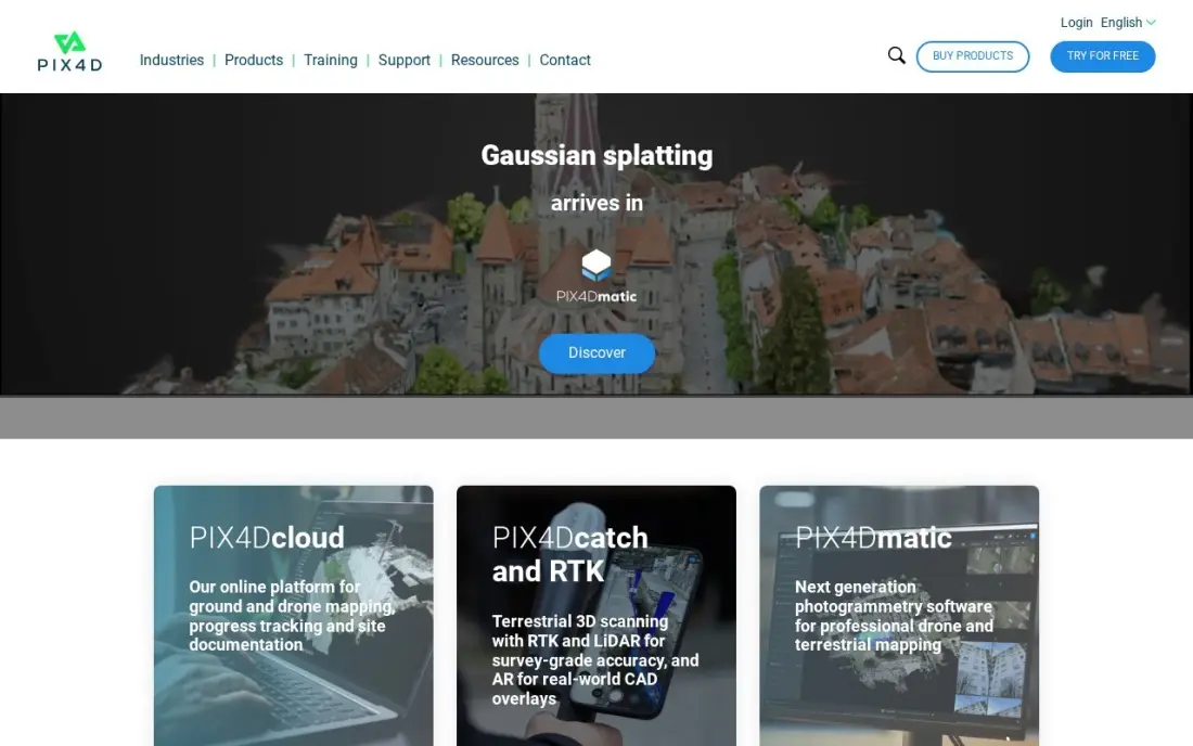
Pix4D is the photogrammetry engine surveyors trust when measurements must stand up to review. PIX4Dmatic Standard costs $3,990 a year, about $333 a month, and turns drone, mobile or LiDAR captures into orthomosaics, point clouds and 3D models, with outputs that plug into CAD and GIS. PIX4Dcloud Starter costs $1,290 a year for teams that prefer cloud processing.
The learning curve is steeper than DroneDeploy's, and the product line is changing: PIX4Dmapper stops being sold on January 1, 2027, so new buyers should learn PIX4Dmatic. Choose Pix4D when accuracy and control over every processing setting matter more than speed of setup.
What we like
- The most accurate photogrammetry engine in this list, trusted by surveyors
- Desktop and cloud options, with outputs that plug into CAD and GIS workflows
- PIX4Dcatch turns a phone into a LiDAR-assisted capture device
- Accuracy and audit trail suit survey and engineering work that must stand up to review
Watch out for
- Steep learning curve compared with one-click measurement tools
- PIX4Dmapper stops being sold on January 1, 2027, so buyers must learn PIX4Dmatic
- Slower to get started than DroneDeploy when speed of setup matters more than control

Agisoft Metashape
Best for: Pilots and small mapping firms that want desktop photogrammetry for a one-off licence fee
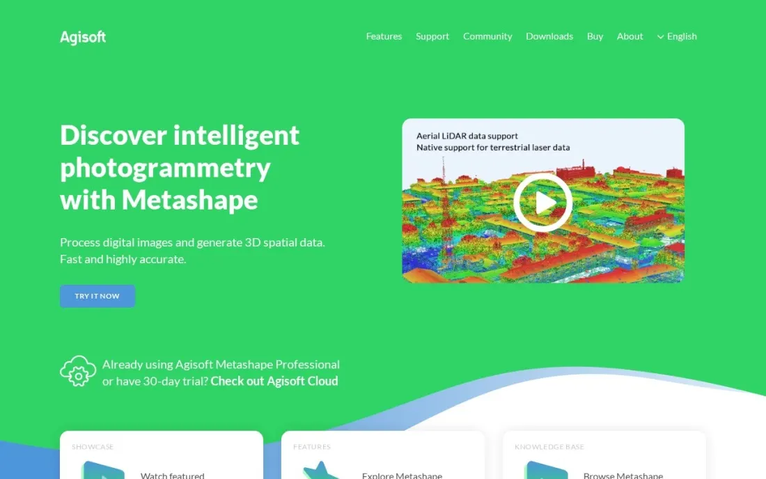
Agisoft Metashape is the desktop photogrammetry tool for buyers who would rather pay once than pay every year. The Standard Edition costs $179 for a node-locked licence and suits 3D models of objects and small scenes, while the Professional Edition costs $3,499 and is the version mapping and survey work needs. Owners of Standard can upgrade to Professional for $3,320.
Processing runs on your own machine, so a fast computer with a good graphics card matters, and there is no cloud sharing like DroneDeploy's. Floating licences for teams are sold through resellers by quote. For a small mapping firm, Professional's one-off price is often below a year of subscription rivals.
What we like
- Standard Edition costs $179 for a node-locked licence, far below annual photogrammetry subscriptions
- Professional Edition at $3,499 adds the mapping and survey workflows professionals need
- Upgrading from Standard to Professional costs $3,320, so you can start small
- Runs on your own computer, so large image sets do not depend on upload speeds
Watch out for
- Floating licences are sold only through resellers by quote
- Desktop processing needs a powerful computer with a strong graphics card
- The online store currently accepts only wire transfer, ACH and SEPA Direct Debit
Airdata
Best for: Pilots and small drone teams that need flight logs, battery health and maintenance records
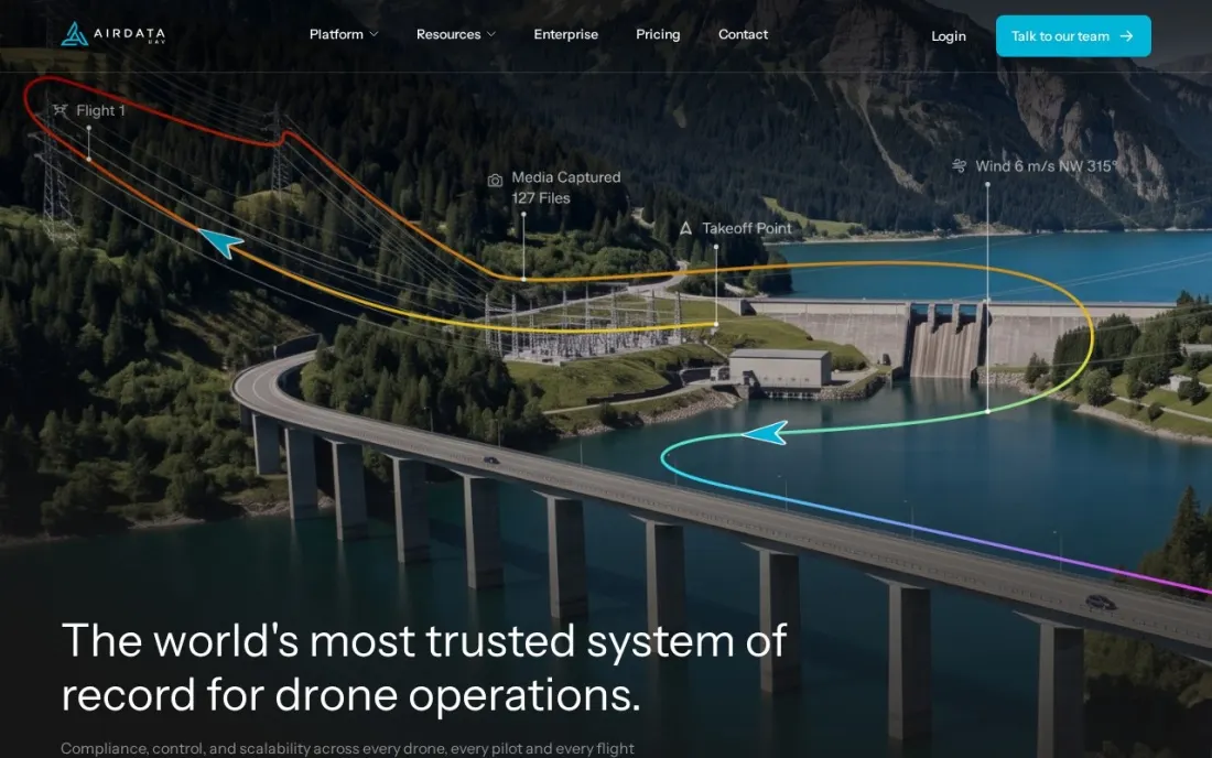
Airdata is the flight log and fleet health tool for pilots who need records more than maps. It syncs flight logs and tracks battery health, and the free plan keeps 100 active flights for one pilot with battery diagnostics and CSV and KML export. HD 360 Gold costs $6.99 a month billed monthly and adds battery trends and maintenance tracking for up to 8 drones and 16 batteries.
HD 360 Pro costs $14.99 a month billed monthly, or $164.89 billed annually, for 3,000 flights, 4 pilots and 16 drones, and adds regulatory reports and equipment alerts. Enterprise is quoted per drone and adds API access and mission planning, with live streaming as an add-on. It is the cheapest way to keep compliance records.
What we like
- Free plan keeps 100 active flights with battery diagnostics and CSV and KML export
- HD 360 Gold at $6.99 a month adds battery trends and maintenance tracking for 8 drones
- HD 360 Pro adds regulatory reports and equipment alerts for 4 pilots and 16 drones
- Enterprise adds API access, mission planning and unlimited flight archive
Watch out for
- Live streaming and asset management are Enterprise add-ons only
- Enterprise is priced per drone by quote
- Restoring archived flights costs $15 on paid plans

Aloft
Best for: Pilots who need airspace checks and LAANC authorizations, and teams that need fleet compliance
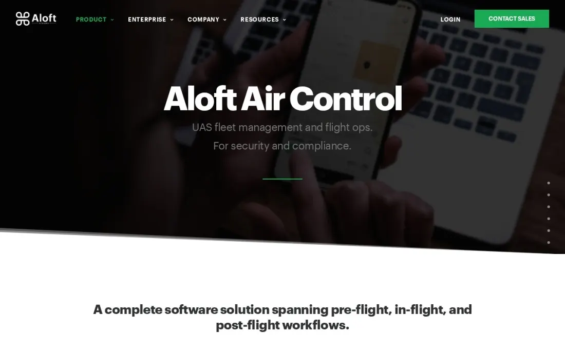
Aloft is the airspace and compliance layer of a drone program. It is an FAA-approved UAS Service Supplier for LAANC, so pilots can request authorization to fly in controlled airspace, and its Air Control product adds fleet management, preflight checklists, flight planning, searchable flight logs and live streaming with two-way audio. It is free for individual pilots, recreational or commercial.
Teams are a different matter. Aloft's terms require a subscription for enterprise use, and Enterprise pricing is not published, so a business with several pilots must talk to sales. It does not build maps or models, so most operators pair it with DroneDeploy, Pix4D or Metashape.
What we like
- Free for individual pilots, whether they fly recreationally or commercially
- FAA-approved UAS Service Supplier for LAANC airspace authorizations
- Air Control covers fleet management, preflight checklists, flight logging and live streaming
- Vendor states it has passed a SOC 2 Type 2 audit
Watch out for
- Enterprise pricing is not published; teams must contact sales
- Terms of service require a paid subscription for enterprise use
- No photogrammetry, so mapping needs a second tool

Skydio
Best for: Inspection teams that want autonomous close-range flight around structures with US-made drones
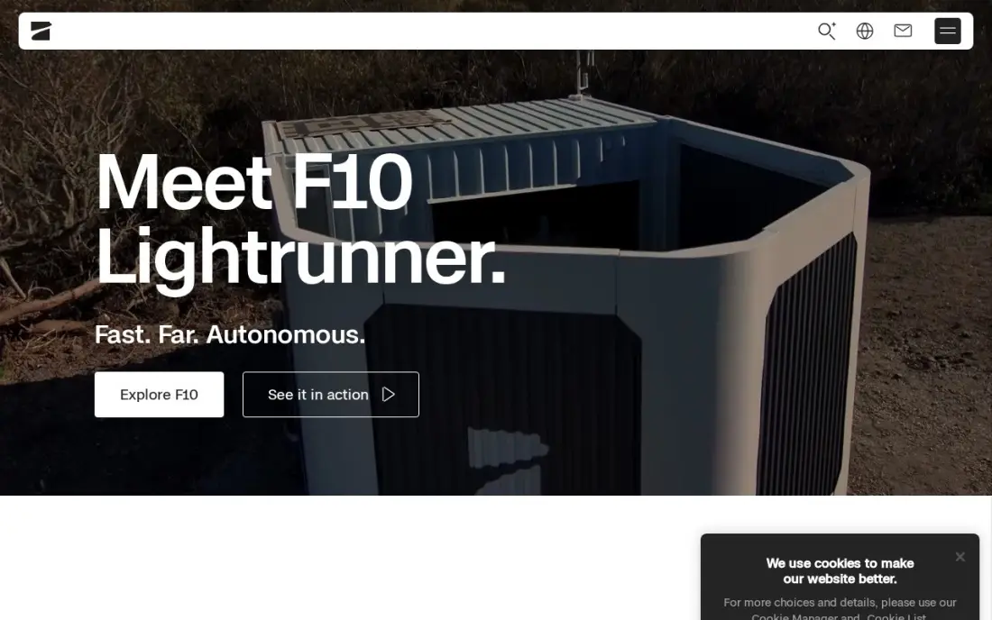
Skydio is a drone maker whose software is the reason buyers choose it. Its drones fly themselves around structures with strong obstacle avoidance, and the 3D Scan software automates the capture pattern for buildings, bridges and roofs, which gives consistent coverage without a highly skilled pilot. The drones are US-manufactured, which matters for government and some enterprise buyers.
You are buying hardware as much as software: 3D Scan is sold with Skydio drone bundles and has no separate published price. Imagery exports to DroneDeploy, Pix4D and Bentley ContextCapture, so processing usually means a second subscription. Choose Skydio when safe, repeatable close-range capture is the hard part of the job.
What we like
- Best-in-class autonomous flight and obstacle avoidance for close-range capture
- 3D Scan automates the data-collection pattern for buildings and roofs
- US-manufactured, which matters for government and enterprise buyers
- Imagery exports to DroneDeploy, Pix4D and Bentley ContextCapture
Watch out for
- You are buying drones, so the software value is inseparable from a hardware purchase
- 3D Scan pricing is bundled with aircraft and not published on its own
- Pairing with DroneDeploy or Pix4D for processing adds a second subscription

ArcGIS Pro
Best for: GIS teams that need drone maps inside a wider mapping and analysis system
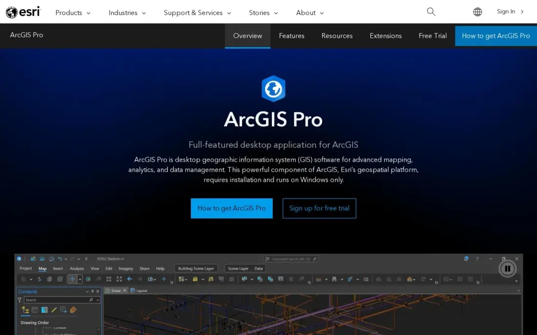
ArcGIS Pro is where many organizations' drone maps end up rather than where they are flown. It is the industry-standard desktop GIS for mapping, editing, spatial analysis and 3D visualization, and it shares logins, data and apps with ArcGIS Online and Living Atlas, so orthomosaics from a drone flight can sit beside property, utility and planning layers.
Esri quotes commercial licences per organization, so there is no published business price, and the desktop app runs on Windows only. The $100-a-year Personal Use licence is for noncommercial projects and there is a 21-day free trial. Choose it when drone data has to feed an existing GIS, not as a first drone tool.
What we like
- The industry-standard desktop GIS, with 2D, 3D and 4D visualisation and deep spatial analysis
- Sits inside the ArcGIS system: ArcGIS Online, Living Atlas data and ready-to-use apps share the same login
- The Personal Use licence bundles ArcGIS Pro Basic, popular extensions, 200 service credits and Esri training
Watch out for
- Commercial licences are quoted by Esri — there is no published price for a business seat
- The desktop app runs on Windows only, so Mac and Linux teams need a workaround
- The Personal Use licence is for noncommercial projects only and cannot be used for client work
The best drone software turns flights into something a client can use — a map, a 3D model, an inspection record — and keeps the paperwork that keeps a drone program legal. We compared seven tools across mapping platforms, photogrammetry engines, flight-log and fleet tools, airspace apps and GIS, and every price below comes from the vendor's own pricing page or our verified records as checked in November 2026.
How to choose the best drone software
- Start with the deliverable. Maps and 3D models need a processing tool; inspection records and compliance need a logging tool; most programs need both.
- Decide between cloud and desktop. Cloud platforms process anywhere but bill every year; desktop tools cost less over time but need a strong computer.
- Check accuracy needs. Survey and engineering work needs ground control support and an audit trail; progress photos and roof checks do not.
- Count pilots and drones. Several tools price per user or per drone, so a growing team can change the bill faster than new features do.
- Plan for airspace and records. Commercial pilots need authorizations, flight logs and maintenance records; a free tool covers a solo pilot, but teams need shared records.
- Confirm hardware support. Check the tool supports your drone model before paying, especially for automated flight and thermal cameras.
A drone business wins work through search as much as word of mouth. If you sell mapping or inspection services locally, our local SEO service helps you show up when clients search, and the free local business schema generator helps Google read your service area correctly.
Which drone software fits your situation
A solo pilot starting a commercial drone business. Begin with the free tools: Aloft is free for individual pilots, recreational or commercial, for airspace checks and LAANC authorizations, and Airdata's free plan keeps 100 active flights with battery diagnostics. Add processing only when clients ask for maps or models; Agisoft Metashape Standard at $179 is the cheapest way to try 3D models of objects and small scenes.
A small mapping firm that would rather pay once than every year. Agisoft Metashape Professional costs $3,499 for a node-locked licence, less than a single year of PIX4Dmatic or DroneDeploy, and runs on your own computer so uploads do not slow you down. Budget for a machine with a strong graphics card, and note there is no cloud sharing and floating licences are sold only through resellers.
A construction, energy or inspection team that flies weekly. DroneDeploy plans automated flights, processes images in the cloud and returns orthomosaics and 3D models, and it integrates with Autodesk Construction Cloud and Skydio drones. The Individual plan is $4,188 a year for one admin user, so a second user means a quote-only team plan.
A surveyor or engineer whose measurements must stand up to review. Pix4D gives survey-grade accuracy and control over every processing setting, with outputs for CAD and GIS. PIX4Dmatic Standard costs $3,990 a year, or PIX4Dcloud Starter $1,290 a year for cloud processing. Learn PIX4Dmatic, since PIX4Dmapper stops being sold on January 1, 2027.
An organisation running a drone program with several pilots. Keep shared records in Airdata HD 360 Pro at $164.89 a year billed annually for 4 pilots, 16 drones and regulatory reports, and check Aloft Enterprise by quote, since its terms require a subscription for enterprise use. If close-range capture around structures is the hard part, Skydio's 3D Scan comes with its US-made drones, and if drone maps must feed an existing GIS, ArcGIS Pro is where they land, on Windows only.
Drone software pricing: what you will actually pay
Take a two-pilot mapping business. For processing, DroneDeploy Individual costs $4,188 a year for one admin user, so a second user means a quote-only team plan. PIX4Dmatic Standard costs $3,990 a year, or PIX4Dcloud Starter $1,290 a year for cloud processing. Agisoft Metashape Professional costs $3,499 once for a node-locked licence, which is less than a single year of PIX4Dmatic or DroneDeploy, though it ties processing to one computer.
For records, Airdata HD 360 Gold costs $6.99 a month billed monthly for 2 shared pilots and 8 drones, and HD 360 Pro costs $14.99 a month, or $164.89 billed annually, for 4 pilots, 16 drones and regulatory reports. Aloft is free for each individual pilot, and Enterprise pricing is by quote. A lean setup of Metashape Professional plus Airdata Pro costs $3,499 plus $164.89 in year one and $164.89 a year after that; a cloud setup of DroneDeploy plus Airdata Pro costs $4,352.89 every year.
Know the difference: processing software vs flight operations software
Processing software turns images into data. DroneDeploy, Pix4D and Agisoft Metashape stitch hundreds of photos into orthomosaics, point clouds and 3D models, and their price reflects the computing and accuracy involved. This is the software clients pay for, because it produces the deliverable.
Flight operations software keeps the program running. Airdata and Aloft record flights, battery health, maintenance and airspace authorizations, and give a manager one view of pilots and aircraft. It produces no client deliverable, but it is what you show an insurer, an auditor or a regulator, and it is cheap compared with processing. Most commercial operators need one tool from each group.
Quick comparison: tool type by need
| Buyer | Best pick | Why |
|---|---|---|
| Construction and inspection teams | DroneDeploy | Flight planning, cloud maps and 3D models, $4,188/year |
| Surveyors and engineers | Pix4D | Survey-grade photogrammetry, PIX4Dmatic $3,990/year |
| Budget mapping firms | Agisoft Metashape | Desktop licence from $179, Professional $3,499 |
| Flight logs and maintenance | Airdata | Free plan, HD 360 Pro $14.99/month |
| Airspace and compliance | Aloft | Free LAANC for individuals, Enterprise by quote |
| Close-range autonomous capture | Skydio | 3D Scan sold with Skydio drones, by quote |
| GIS teams | ArcGIS Pro | Drone maps inside the Esri system, by quote |
Mistakes to avoid
- Buying processing power you will not use. Survey-grade software is wasted on progress photos; match the tool to the accuracy clients pay for.
- Skipping flight records. Logs, battery history and maintenance records are cheap to keep and expensive to recreate after an incident.
- Forgetting the computer. Desktop photogrammetry needs a strong graphics card; budget for the hardware alongside the licence.
- Assuming every drone is supported. Automated flight and thermal controls vary by aircraft, so test with your exact model.
- Ignoring per-user limits. Single-user plans look cheap until a second pilot needs a login.
Related comparisons: Drone Roof Inspection Software
How we chose
We grouped drone software by the job it does — processing, flight operations, autonomous capture and GIS — and checked each price on the vendor's pricing page or in our verified records in November 2026, noting monthly and annual billing. Agisoft Metashape, Airdata and Aloft were checked on their own pages on November 16, 2026. Where a vendor publishes no price, we say so. We ranked by fit for the most common buyer, a small commercial drone business or in-house drone team. No vendor paid for a place in this list, and none of the links here are affiliate links.
What to do next
Write down your main deliverable and how many pilots fly each month, then trial one processing tool and set up a free Airdata or Aloft account for records the same week. If you sell drone services and want more clients to find you, we can help. Book a free SEO review.
Frequently asked questions
What is the best drone software?
DroneDeploy is the best all-in-one drone platform for most businesses, with flight planning, cloud processing and 3D models at $4,188 a year for one pilot. Pix4D suits survey-grade work, Agisoft Metashape is the low-cost desktop option from $179, and Airdata and Aloft cover flight logs and airspace compliance.
Is there free drone software?
Yes. Airdata has a free plan for 100 active flights with battery diagnostics, and Aloft is free for individual pilots for airspace checks and LAANC authorizations. Mapping and photogrammetry tools in this list are paid.
What software do drone mapping companies use?
Most use DroneDeploy or Pix4D for flight planning and processing, or Agisoft Metashape Professional for desktop photogrammetry, then deliver results into CAD or GIS such as ArcGIS Pro. Many also run Airdata or Aloft for flight records and airspace authorizations.
How much does drone mapping software cost?
On published prices, Agisoft Metashape Professional costs $3,499 for a node-locked licence, PIX4Dcloud Starter costs $1,290 a year, PIX4Dmatic Standard costs $3,990 a year and DroneDeploy Individual costs $4,188 a year billed annually. Team plans for DroneDeploy are quote-only.
Do I need software to get LAANC authorization?
Yes. LAANC authorizations are requested through an FAA-approved UAS Service Supplier app. Aloft is one of them and is free for individual pilots, while teams need its paid Enterprise subscription.
What is the difference between DroneDeploy and Pix4D?
DroneDeploy is a cloud platform built for fast results across construction, energy and inspection, with flight planning and processing in one place. Pix4D is a photogrammetry engine with more control over processing and survey-grade accuracy, with a steeper learning curve.
What is the best drone software for surveying?
Pix4D is the pick for surveying: it is the photogrammetry engine surveyors trust when measurements must stand up to review, with survey-grade accuracy and control over every processing setting, and PIX4Dmatic costs $3,990 a year. Agisoft Metashape is the low-cost desktop alternative, though survey work needs the $3,499 Professional Edition, not the $179 Standard one. Survey jobs also need ground control support and an audit trail.
Sources we checked (8)
- DroneDeploy — www.dronedeploy.com/pricing (checked November 8, 2026)
- DroneDeploy reviews on G2 (checked November 8, 2026)
- Pix4D — www.pix4d.com/pricing (checked November 8, 2026)
- Agisoft Metashape — www.agisoft.com/buy/online-store (checked November 16, 2026)
- Airdata — airdata.com/pricing (checked November 16, 2026)
- Aloft — help.aloft.ai/en/articles/7977032-sales-pricing-information (checked November 16, 2026)
- Skydio — www.skydio.com (checked November 7, 2026)
- ArcGIS Pro — www.esri.com/en-us/arcgis/products/arcgis-pro/overview (checked November 10, 2026)
Make one of these tools?
We re-check this list every quarter. Send a correction, request a review, or ask about a clearly labeled sponsored spot.
Request a listingShamim
Founder of SerpAstra
A full-stack digital marketer and SEO strategist covering technical and local SEO, AI search visibility, paid ads and lead generation for local businesses, e-commerce brands and SaaS teams.
Free SEO and AI visibility audit
Find out what is holding your rankings back
Send us your site. Within 2 business days you get a written audit, an AI visibility check and a short fix list ranked by impact. Free, with no contract attached.
Request my free audit→Related buying guides
 Construction & Field Service11 Best Drone Roof Inspection Software in 2026, ComparedCompare the 11 best drone roof inspection software on price, flight automation and measurement reports, with every price checked November 7, 2026.Read guide →
 CAD, GIS & EngineeringBest Geospatial Software for 2026: 10 Options Compared by Use CaseBest geospatial software compared by use case: 10 options with real 2026 prices, free plans and ratings, from free QGIS to enterprise ArcGIS Pro.Read guide →
 Construction & Field ServiceBest Roof Measuring Software for 2026: 10 Options Compared by Use CaseCompare the 10 best roof measuring software options on price per report, turnaround and accuracy, with every price checked November 8, 2026.Read guide →